Difficulty 3 out of 5Distance 18.47 kmElevation gain 468 mDuration 4 h 30 minMaximum altitude 244 mCircular route
Milestone by milestone
The Eagle's peak, soaring over the San Vicente mountain ranges
Long and labyrinthine route from the Morna plain towards the Mala Costa, between the terms of Santa Eulalia del Río and San Juan de Labritja
Milestone by milestone
24/04/2026 - 21:25 h.
4 min
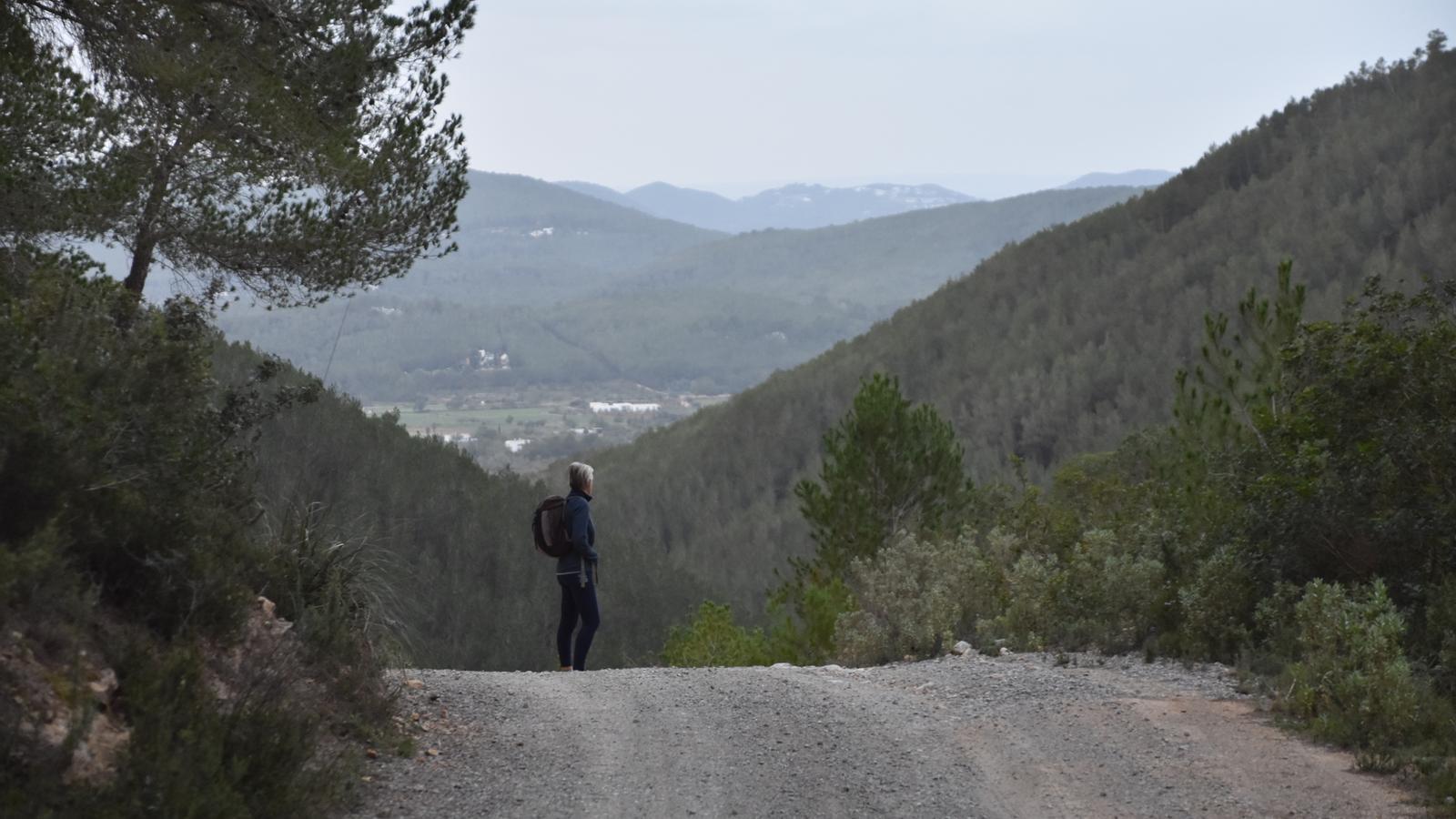
PalmIn this route, we explore one of the most genuine environments of Ibiza, between the terms of Santa Eulalia del Río and San Juan de Labritja. It is a set of mountain ranges and ravines located north of the Morna plain, the continuation towards the northeast of the Amunts. One of these small mountain ranges is Mala Costa or Sierra de Morna, although on the route we also cross the Sierras de San Vicente and San Carlos.
The starting point is located at a specific point on the Camino del Fil, at the height of the Huerto de Josepet, at the beginning of the Camino del Horno del Saig. This path, Camino del Fil, which currently connects San Carlos de Peralta and San Lorenzo de Baláfia, was the old path along which the telegraph wire ran in its northern layout, which connected the telegraph station of the city of Ibiza with Cala de San Vicente, where the wire submerged to reach the island of Mallorca. Another toponym with history that is revealed to us at the beginning of the route, El Horno del Saig, seems to be related to a murder committed against a justice official, a saig who was following this path to reach Cala de San Vicente to execute a sentence of embargo on a property; its owner was precisely working in this oven (in what are now known as the rocks of El Horno del Saig) and, beside himself, upon learning the motive of the official's mission, threw him inside and he died burned.

In this itinerary, we do not have any public transport service that takes us to the starting point. Therefore, we will have to use private vehicles. There is a parking area provided for this purpose at the entrance to the Forn del Saig path.
The route
[00 min] We begin our march along the Forn del Saig path from the Fil path, at the height of Hort d’en Josepet. The cart track advances between properties, well focused towards the north wind and with the perspective of the mountains where we will climb just in front. Little by little, we delve into the slopes of Mala Costa, also called the Morna mountain range. [15 min] The entrance to the gully through which our route runs is marked by Can Pep Sastre and Ca na Vic, two properties on either side of the slope. The path crosses the interior of the tanqueta, where on the sides there are some sets of marginal terraces, and begins to draw the first bends [25 min], where we find signage for a BTT route, number 11. The path ascends two important slopes and reaches a pass, from where two paths start and where we find a fire water tank and a hunting refuge.
From the pass, located above the aforementioned fork, [35 min] we take the path on the left. We begin the descent towards the interior of the valley that opens before us on the left side of a terraced gully. On this stretch of path, we cross the municipal boundary between Santa Eulària des Riu and Sant Joan de Labritja. On the right side of the path, a series of small farms, some with very genuine construction: Can Pujol, Can Blanc, Can Martí, etc. Whitewashed facades, wooden gates, juniper lintels. Our path always advances to the left until it reaches the interior of the valley, crossed by the Cala stream. At this point, [45 min] the dirt track turns sharply to the right on a gentle ascent. Oriented towards the east, we leave the gully through which the stream flows on our right. We pass between Can Rota Vella and Can Botigues and shortly after reach an important fork [1 h 20 min], where we take the path on the right, clearly descending towards the interior of the gully.

Upon seeing a white well with a chapel, well whitewashed, to the right of the track, the Well of Can Joan del Cirer, we leave it to follow a path that is born at the foot of this small hydraulic construction. [1 h 25 min] The path enters the ravine, following the course of the Cala torrent below the houses of Can Joan des Cirer. After a while, we come out onto a dirt track [1 h 40 min] that continues downhill, well oriented towards gregal (northeast). We find ourselves at the end of the slopes of Puig de l’Àguila, although still far from being able to see it. The path goes up and down continuously. The next two forks, always to the left. [2 h 00 min] We come out onto an asphalted road which we follow to the right, oriented towards the east. To our left we can now see Sant Vicent de la Cala. After a sharp right turn [2 h 10 min], we leave the asphalted road on the right, following a dirt track which, initially oriented towards the south, gradually climbs us up the slope of Puig de l’Àguila.
Cas Vildo Perot
We leave on the right a beautiful white house, Can Gat, which borders the path; at the next fork [2 h 30 min], we turn left, now with Puig de l'Àguila directly in front of us. The path brings us closer to a pass, where we find the houses of Can Jaume de l'Àguila perched high up and, a little further up, the well from which they must have obtained water. [2 h 55 min] Past the pass, we leave Puig de l'Àguila well to our left, and approach other houses, Cas Vildo Perot. Some signs warn us of various misfortunes if we continue straight ahead, which forces us to follow another path, two 'marjadas' further up on the right. [3 h 10 min] After this small setback, we emerge onto the dirt path we left earlier and begin a 'dizzying' descent. The path descends steeply and is concreted to a pass, where the ruins of Can Blai can be glimpsed among the branches. [3 h 20 min] We leave the houses to the left and continue down the track.
The path rises gently before reaching the road from Sant Carles to Sant Vicent. We, however, will not reach it. [3 h 40 min] Instead, we will take a path on the right that crosses a group of houses and borders a threshing floor which we leave on our right. From here, the orientation is clear, towards the west (southwest), following a small chain of paths and trails that will guide us until we reach the Fil path [4 h 05 min]. From here, we proceed cautiously along the left side of the road to progressively close the circuit until we reach the facilities of l'Hort d'en Josepet, which has been dedicated to citrus production since 1969, where our route ends [4 h 30 min].
THE DATA
