Difficulty 2 out of 5Distance 9 kmElevation gain 231 mDuration 3 h 00 minMaximum altitude 177 mNot a circular route
Milestone by milestone
The lower road of Son Bunyola, an old and historic way
Simple, familiar and very summery hike along the maritime slope of the Tramuntana mountain range between Banyalbufar and the port of Canonge
10/07/2026 - 20:54 h.
4 min
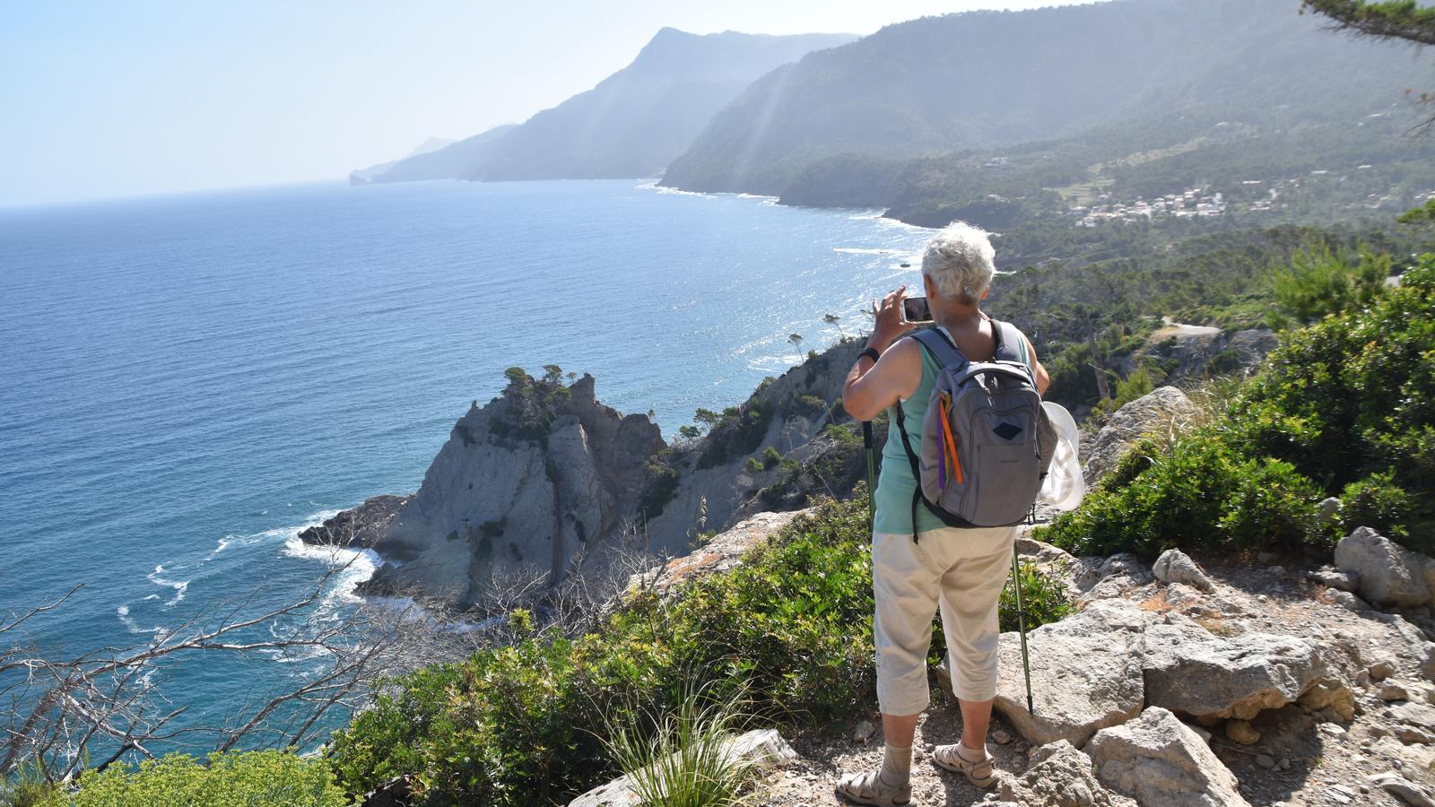
PalmaOn this route, we will travel along the camí de Baix of Son Bunyola, an old and historic path that connects Banyalbufar with the port of El Canonge via the maritime slope of the Serra. The simple, family-friendly, and very summery itinerary allows us to rediscover one of the most beautiful coastal perspectives of the Tramuntana. A cultural landscape marked by human presence over the centuries – dry stone walls, springs, irrigation channels, and washhouses – and the fierce resistance against piracy, where the complicit silences of smugglers still echo.
The camí de Baix is also known as 'la volta del General'. However, this popular toponym, more recent than the previous one and perfectly localized, has spread throughout the path. It refers to General Fernando Cotoner y Chacón (1817-1888), owner of the Barony of Banyalbufar, who, at the end of the 19th century, in addition to contributing to the repair of the main road, the current Ma-10, spent long hours at the aforementioned bend contemplating the village. From here, we join once again the historic claim of Tomàs Vibot, who, since the publication of Son Bunyola, una mar de noms in 1999 until the third volume of Mallorca Litoral. 15 rutes per la frontera illenca, published this year, reminds us that “the path that connects Banyalbufar with the port of El Canonge, passing through Son Bunyola, is called, has been called and, most importantly, has always been documented as the camí de Baix. Nothing about volta del General. The volta del General itself is nothing more than the curve that the road describes just at the beginning of the path, next to La Cabarola, where the noble General Cotoner, owner of the Barony of Banyalbufar, used to sit to enjoy the delicious maritime landscape of the village”. Toponymy is a science that does not admit amateur experiments.
Our starting and arrival point is the aforementioned bend in the Ma-10 road (km 85.250) before reaching Banyalbufar, coming from the Esporles side via the Coll de la Bastida. The new road has cut off a bend, creating a landing, guarded by a couple of carob trees and perfectly conditioned as a car park, where numerous hikers park who come here to do a route that has long since become a classic itinerary as a walk to Port del Canonge. We can access it by public transport. These are the lines that take us there: the L-202 Estellencs-Palma and the L-131 Santa Ponça-Banyalbufar. On the website tib.org you will find all the information about timetables and availability. The closest stop to the starting point of the route is 1 km away in the direction of the village.

The route
[00 min] We start our excursion at the volta del General, from where we set off on a dirt path perpendicular to the sea. Wooden signs point us to the route that, from now on, will lead us in a gentle descent to the port of Canonge, a haven for fishermen and a coastal hamlet belonging to Banyalbufar, although it is mainly inhabited by people from Esporles. Soon, to our left, we find a villa, called la Cobarola, from which a beautiful and spectacular panorama of the village is obtained, with the mola de Planícia as a backdrop.
Archduke Lluís Salvador, at the end of the 19th century, describes this itinerary and mentions that only a narrow path crossed the entire pine forest. The substantial change occurred during the early years of the thirties of the 20th century, when Josep Puig i Canals, then owner of Son Bunyola, decided to widen the entire path between corral Fals and volta del General (Son Bunyola, una mar de noms, Tomàs Vibot, 1999). Just after passing la Cobarola, the path goes by a modern cistern and, shortly after [05 min], crosses the gate to the Son Bunyola estate. Immediately afterwards, after the first 500 meters of our itinerary, we leave to our left a path that climbs from pla del Cavall to the main route, very close to which we find the cave of na Bernada.
We take a break to discuss this area, much visited by hikers and, more anciently, by daring fishermen and smugglers. Indeed, the aforementioned cave was very likely used as a smuggling 'secret' and, as Vibot describes in the third volume of Mallorca litoral (2026), it was also used as a secret refuge. Here, one would lend an ear to hear the oars and the timbers of pirates in the water in those centuries of hard resistance against the dangers of the sea, between spring and autumn.
El pi de la Consulta
As we pointed out before, we follow the wooden signs of the Ruta de Pedra en Sec (Stone Dry Route) all the time, permanently guided by the heights of puig de les Planes (339m) and with the view of punta del Cavall, towards the sea. We pass by some old constructions, Pere Antoni's little house, and a charcoal burner's silo next to it. We walk on flat ground among vegetation dominated by pine trees, strawberry trees, reeds, and some holm oaks, among others. [30 min] We come across the pi de la Consulta, a toponym that refers to the time when the carabineers watched over this coast. Just on the other side, to the right, we find a lime kiln. Little by little, the path becomes sheltered under the slopes of puig de les Planes, heavily affected by the landslides produced during the 2020 storm, and brings us closer to the caves of corral Fals [40 min], at the foot of the Revellar, the northeast spur of the aforementioned peak.
Now already in a rapid descent, our path joins [45 min] the paved road that descends from the houses of Son Bunyola. The wooden signs will lead us along the original path, which winds through small hills, very close to the sea. [50 min] From the path, looking at the sea, we contemplate the sharp, serrated spur of punta de l’Àguila (where another hiding place was located) and, immediately to the right, the Carregador beach and the Garroves loading area, toponyms that indicate places traditionally used for maritime transport, especially of agricultural products, and which reveal the difficulty that in the past it meant to do so via inland paths.
[1 h 00 min] We cross the torrent and the beach of Son Bunyola (we will identify it by the presence of two small harbors). Shortly before reaching the port of Canonge, [1h 15 min] we cross another torrent, that of Son Coll, at the end of which Cala Gata is located. From here, we climb with two grips onto a large esplanade, called the tanca de la Mar, behind which we find the port houses and the cove with its small harbors [1 h 30min]. We will return to the volta del General by the same Baix path, in reverse direction [3 h 00 min].
The data
@Fita_a_Fita
